Publisher's description - Land Measure Pro 1.0.0
Measure area and length on a map.
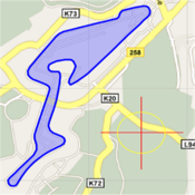
Uses layers to manage multiple related measurements.
Customizable colors and labels for each layer.
Store measurements locally, output professional images to printer.
Trace the outline of any feature visible on the map, creating a series of connected points the area and perimeter are continuously updated.
Extremely complex shapes can be handled with virtually no limit.
Can be switched between Metric and Imperial units (hectares, sq.km. sq.m, acres, sq.miles, sq.yrds, sq.ft) at any time, and can be switched from measuring areas to simple lengths.
You can zoom to your current location, search for an address, or manually pan/zoom to any place in the world.