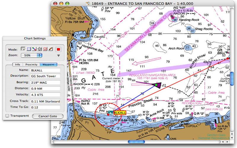
A very affordable solution for the boater that wants to take the Mac aboard for real-time display of position on full color marine raster format BSB and Softcharts. Plug your GPS into your Mac and watch as your boat moves along in real-time, plotting a track behind the boat and logging your historic position on a digital chart.
GPSNavX™ is right at home for planning trips and charting new destinations. A GPS is not required to work with charts.
GPSNavX™ includes a small scale world marine chart and detailed marine charts are available separately from many sources (including the free NOAA).
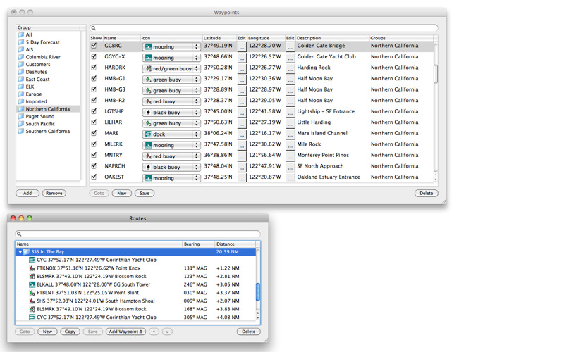
In addition to real-time chart plotting, GPSNavX™ supports waypoints & routes including KML (Google Earth) and GPX import/export, track log, measuring bearing/distance, GRIB weather forecast, tides/currents, AIS and anchor alarm.
GPSNavX™ is updated frequently and all updates are provided at no additional expense.